Surface Geophysical Methods – Seismic Methods
2. Surface wave seismic survey
a. Multi-channel Analysis of Survey Wave (MASW)
b. Microtremor survey (MAM)
1. Seismic Refraction
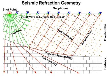
Seismic Refraction is one of the most suitable and efficient investigation techniques for earthwork rippability assessments or bedrock level investigation.
Applications
- Map bedrock topography
- Map faults in bedrock
- Estimate depth to groundwater
- Estimate bedrock rippability
- Evaluate rock properties
Limitation
- only applicable for seismic velocities increase with depth
- total geophone length requires 4-5 times of desired depth of interest
| Source | Depth of Investigation |
| Sledge Hammer | 20-45m |
| Weight drop | 30-60m |
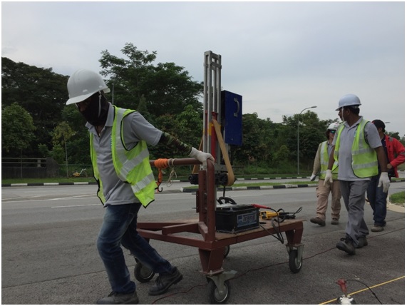

2. Surface wave seismic survey
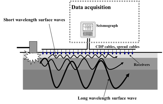
A wide variety of seismic waves propagate along the surface of the earth. They are called surface waves because their amplitude decreases exponentially with increasing depth. The Rayleigh wave is used in engineering studies because of its simplicity and the close relationship of its velocity to the shear-wave velocity for earth materials.
Applications
- Earthquake site response
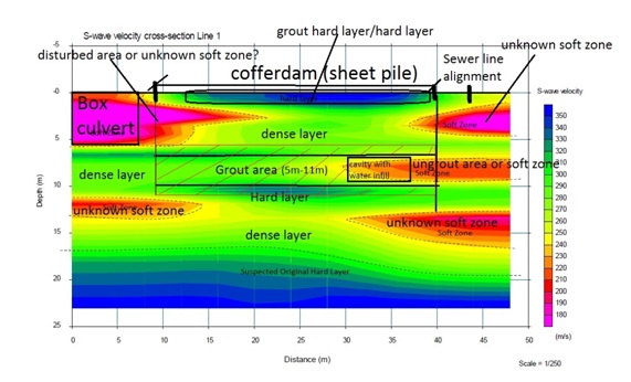
- Assessment of weak zones
- Soil compaction control
- Pavement evaluation
- Mapping subsurface stratigraphy
Surface wave seismic survey can divide into two groups based on the source usage.
| Survey | Source | Depth of investigation | Length of Geophone |
| MASW | Active | 2-20m | 2 times of interested depth |
| MAM | Passive | 5-1000m | Similar of interested depth |
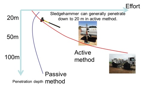
a. Multi-channel Analysis of Survey Wave (MASW)
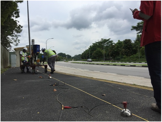
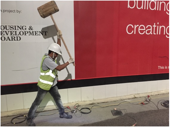
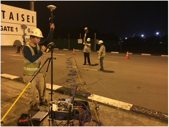
Multi-channel Analysis of Surface Waves (MASW) is effective for investigating shallow geological structure and, in particular, the relative shear strength of subsurface materials. It is the conventional mode of survey using an active seismic source (e.g., a sledge hammer or weight drop) and a linear geophone receiver array, collecting data in a roll-along mode.

b. Microtremor Array Measurements (MAM)
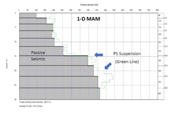
Microtremor array measurements (MAM), is particularly effective and efficient for estimation of deep S-wave velocity structure because it does not require an artificial source and depth of investigation can be easily extended by increasing the array size.
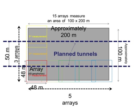
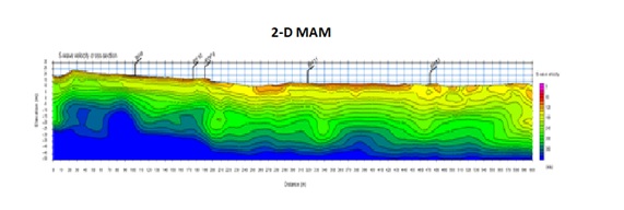
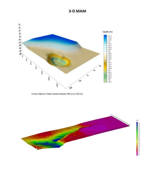
The source can cause by artificial man-made (i.e., traffic vibration, factories vibration, etc.) or natural disturbances (i.e., wind and ocean movement). MAM is able to detect the subsurface in 1D, 2D & 3D. 1D MAM gives the overall depth of the investigation area. 2D & 3D MAM displays the cross-sections and profiles of a survey line in different perspectives.
